A rather significant change in the forecast occurred overnight as most computer model simulations are now depicting a developing low pressure system over the Great Lakes region that could bring southern Wisconsin accumulating snow late Wednesday night through Thursday night.
After a sunny and mild day today, with highs around 50, low pressure and colder air will invade the area. The two looping images below show the weather pattern at both the ground level and at 18,000ft above the ground between Wednesday morning and Friday morning. Click the images for a larger version of each loop.
After a sunny and mild day today, with highs around 50, low pressure and colder air will invade the area. The two looping images below show the weather pattern at both the ground level and at 18,000ft above the ground between Wednesday morning and Friday morning. Click the images for a larger version of each loop.
 |  |
The surface low drops into the Great Lakes on Wednesday, moves just east of Wisconsin, then holds nearly stationary as it intensifies through Thursday night. This intensification occurs due to the energy arriving in the upper levels of the atmosphere, as depicted by the loop on the right. This evolution is complex and highly prone to changes/adjustments going forward.
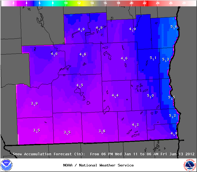
The current forecast calls for between 3 to just over 5 inches of snow across south central and southeast Wisconsin between late Wednesday night and Thursday night. See the accumulation map below. These amounts are highly dependant on the final evolution and track of the storm system. In addition, brisk northwest winds of 15 to 20 mph Thursday and Thursday night could lead to drifting snow.
The current forecast calls for between 3 to just over 5 inches of snow across south central and southeast Wisconsin between late Wednesday night and Thursday night. See the accumulation map below. These amounts are highly dependant on the final evolution and track of the storm system. In addition, brisk northwest winds of 15 to 20 mph Thursday and Thursday night could lead to drifting snow.
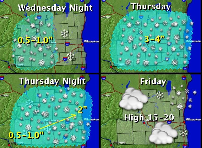
The next image shows the general timing of the snowfall across southern Wisconsin.
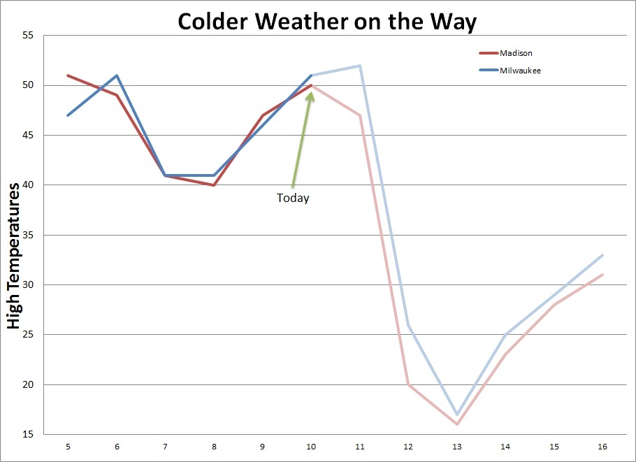
One thing looks for certain, colder air will be pouring into the Upper Midwest for the latter half of the week. This is quite a change from the last few days. The graph below shows where we've been with high temperatures since the 5th of January, and where the forecast takes us through the 16th of January.
Source: http://www.crh.noaa.gov/news/display_cmsstory.php?wfo=mkx&storyid=77471&source=0
 RSS Feed
