The low pressure system that will bring severe weather to the region this afternoon and evening will continue to strengthen as it moves northeast from northeast Nebraska to northern Wisconsin overnight.
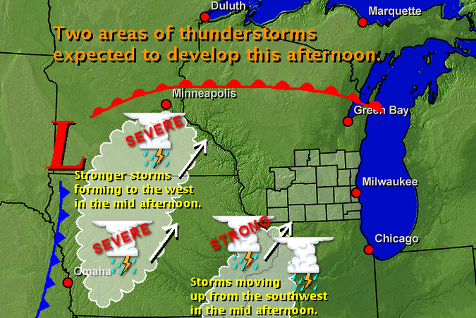
The warm front associated with the low has pushed north of southern Wisconsin, allowing warm and humid air to settle in. For the first half of this afternoon we are expecting scattered showers and isolated thunderstorms, mainly in south central Wisconsin. However, there are two areas of stronger thunderstorms expected to affect southern Wisconsin later this afternoon and this evening.
The strongest of the two will form in southern Minnesota and western Iowa in the midafternoon, ahead of the cold front associated with the approaching low pressure system. The storms will then track northeast toward Wisconsin late this afternoon and this evening. Moderate instability and strong wind shear will be present ahead of the cold front and will likely result in severe thunderstorms. Large hail, damaging winds and tornadoes all are expected.Another area of showers and storms, currently over the mid-Mississippi Valley, will continue to move northeast towards southern Wisconsin this afternoon. This area of showers and storms has developed where conditions are less favorable for storms to become severe; however, it is still a possibility.
 RSS Feed
