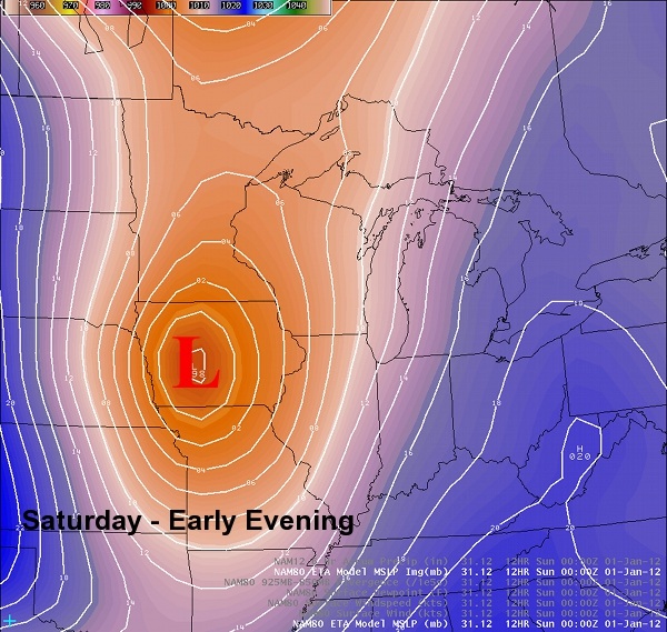
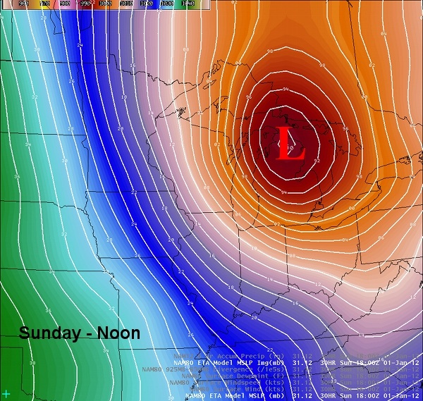
A low pressure system moving through the Central Plains today will reach central Iowa by this evening, then intensify rapidly as it moves northeast across southern Wisconsin tonight. The two images below show the progression of the low from Iowa this evening, to northern Lower Michigan by noon on Saturday.
Brisk southerly winds ahead of the low will push warmer air into the region. Precipitation with the low will start out as rain later this evening, then quickly change over to snow after midnight as temperatures fall behind an associated cold front that plows through. The rapid deepening of the low will also cause the atmosphere to quickly cool down. One to 3 inches of snow accumulation will be possible for later tonight through Sunday morning.
The biggest danger with this storm will be the intense westerly winds that will developed, coupled with the newly fallen snow. West winds could gust to as high as 50 mph with blowing snow possibly restricting visibility to 1/2 mile or less at times.
Winter Weather Advisories are in effect for parts of south central and southeast Wisconsin for this dangerous storm.
 RSS Feed
